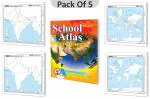
GOWOO presents School Atlas, a comprehensive geographical reference Charts that comes in the latest edition with more than 120 pages. It is printed in four-color, meaning the pages are printed using four different ink colors, giving the atlas a vivid and attractive appearance. The atlas is printed on high-quality art paper, enhancing the Charts's durability and longevity.The atlas is an excellent resource for students of all ages studying geography. It includes detailed maps of the world, continents, countries, and major cities. The maps are accompanied by informative and educational content that covers a wide range of topics, including geography, history, culture, and the environment.The latest edition of Gowoo's school atlas has a user-friendly layout, making it easy for students to navigate and understand. The four-color printing and high-quality art paper ensure that the maps and content are clear and easy to read while providing a visually appealing experience for students.Overall, Gowoo's school atlas is an indispensable tool for students looking to enhance their knowledge and understanding of the world around them. With its comprehensive maps, informative content, and high-quality printing, it is sure to be a valuable addition to any student's Chartshelf. Discover the diversity and beauty of India with Gowoo's India Political Outline Map Pack! This pack contains 100 high-quality maps, each measuring 7x8 inches, that features a clear and concise outline of India's political boundaries. The maps are designed specifically with schools in mind and are perfect for various classroom activities. Gowoo's India Political Outline Maps are meticulously crafted to provide students with an accurate representation of India's states and union territories, including major cities and geographical features. Our maps are printed on durable, high-quality paper, ensuring they will withstand frequent use and handling. The compact size of each map makes it easy to store and transport, making them ideal for use in the classroom or on field trips. Plus, the maps are designed with a clean and straightforward layout, making it easy for students to read and interpret the information. At Gowoo, we understand the importance of providing students with educational resources that are informative and engaging. That's why we've taken care to create maps that are both educational and visually appealing. Our India Political Outline Map Pack is perfect for helping students develop their geography skills and learn more about the diverse and fascinating country of India. Order your pack today and bring the world of India to your classroom with Gowoo's India Political Outline Map Pack! Discover the stunning physical features of India with Gowoo's India Physical Outline Map Pack! This pack contains 100 high-quality maps, each measuring 7x8 inches, with a clear and concise outline of India's physical boundaries. The maps are designed specifically with schools in mind and are perfect for various classroom activities. Gowoo's India Physical Outline Maps are meticulously crafted to provide students with an accurate representation of India's physical geography, including mountain ranges, rivers, and other natural features. Our maps are printed on durable, high-quality paper, ensuring they will withstand frequent use and handling. The compact size of each map makes it easy to store and transport, making them ideal for use in the classroom or on field trips. Plus, the maps are designed with a clean and straightforward layout, making it easy for students to read and interpret the information. At Gowoo, we understand the importance of providing students with educational resources that are informative and engaging. That's why we've taken care to create maps that are both educational and visually appealing. Our India Physical Outline Map Pack is perfect for helping students develop their geography skills and learn more about India's diverse and stunning natural features. Order your pack today and bring the world of India's physical geography to your classroom with Gowoo's India Physical Outline Map Pack! Explore the world with Gowoo's World Political Outline Map Pack! This pack contains 100 high-quality maps, each measuring 7x8 inches, that feature a clear and concise outline of the political boundaries of countries worldwide. The maps are designed specifically with schools in mind and are perfect for various classroom activities. Gowoo's World Political Outline Maps are meticulously crafted to provide students with an accurate representation of the world's political geography, including major countries, capitals, and international boundaries. Our maps are printed on durable, high-quality paper, ensuring they will withstand frequent use and handling. The compact size of each map makes it easy to store and transport, making them ideal for use in the classroom or on field trips. Plus, the maps are designed with a clean and straightforward layout, making it easy for students to read and interpret the information. At Gowoo, we understand the importance of providing students with educational resources that are informative and engaging. That's why we've taken care to create maps that are both educational and visually appealing. Our World Political Outline Map Pack is perfect for helping students develop their geography skills and learn more about the world's political geography. Order your pack today and bring the world to your classroom with Gowoo's World Political Outline Map Pack! Experience the beauty of the world with Gowoo's World Physical Outline Map Pack! This pack contains 100 high-quality maps, each measuring 7x8 inches, with a clear and concise outline of the physical geography of countries worldwide. The maps are designed specifically with schools in mind and are perfect for various classroom activities. Gowoo's World Physical Outline Maps are meticulously crafted to provide students with an accurate representation of the world's physical geography, including mountain ranges, rivers, and other natural features. Our maps are printed on durable, high-quality paper, ensuring they will withstand frequent use and handling. The compact size of each map makes it easy to store and transport, making them ideal for use in the classroom or on field trips. Plus, the maps are designed with a clean and straightforward layout, making it easy for students to read and interpret the information. At Gowoo, we understand the importance of providing students with educational resources that are informative and engaging. That's why we've taken care to create maps that are both educational and visually appealing. Our World Physical Outline Map Pack is perfect for helping students develop their geography skills and learn more about the stunning natural features of the world. Order your pack today and bring the world's physical geography to your classroom with Gowoo's World Physical Outline Map Pack!
)
)
)
)
)
)
)
)
)
)
)
)
)
)