Gowoo's SMALL - 100 India Political Outline Map is a simplified map of India explicitly designed for school students. It shows the political boundaries of India, including the states and union territories. The map is labelled with significant geographical features. It is an educational tool that helps students learn about India's political divisions and geography in a clear and easy-to-understand manner. The measuring small 100 outline maps -political and physical, river outlines map size is 7*8 inch each on the map pad. The school atlas maplitho paper size is 8.5*11 inch. This chart and map are perfect for student use.
The SMALL - 100 India Physical Outline Map is a simplified map of India's physical features, ideal for school students. The map is labelled with important physical landmarks. It helps students visualise and understand the diverse physical geography of India in a simple and accessible way.
The SMALL-1000 India River Outline Map is a simplified map focusing on India's rivers. It highlights the major rivers and their tributaries across the country. The map provides a clear outline of the river systems and their courses. It helps students learn about the rivers of Indiaand their locations, allowing for a better understanding of the country's hydrological features.
The SMALL - 100 World River Outline Map is a simplified map showcasing the major rivers worldwide. It presents the outline of different river systems across continents. The map visually represents the world's prominent rivers and their locations. It serves as an educational tool for students to explore and learn about the rivers that shape the geography of our planet.
The SMALL - 100 World Political Outline Map is a simplified map of the world's political boundaries designed for school students. It shows the outlines of countries and their borders across continents. It provides a basic understanding of global political divisions and facilitates learning about different countries and their locations.
The SMALL-100 World Physical Outline Map The map is labelled with the names of prominent physical landmarks. It helps students explore the diverse physical geography of our planet and understand the natural features that exist globally.
The SMALL - 100 South America Political Outline Map is a simplified map of the political boundaries of South America. It highlights the countries and their borders within the continent. The map is labelled with the significant countries. It assists students in learning about the political divisions and geography of South America in an easily understandable manner.
The SMALL - 100 South America Physical Outline Map is a simplified map focusing on South America's physical features. The map is labelled with the names of critical physical landmarks. It enables students to explore and understand the diverse physical geography of South America in a straightforward and accessible way.
The SMALL - 100 North America Political Outline Map is a simplified map that illustrates the political boundaries of North America. It outlines the countries and their borders within the continent. It serves as an educational resource for students to learn about North America's political divisions and geography quickly.
The SMALL - 100 North America Physical Outline Map is a simplified map showcasing North America's physical features. The map is labelled with the names of critical physical landmarks. It helps students explore and understand the diverse physical geography of North America in a simple and accessible manner.
The SMALL - 100 Europe Political Outline Map is a simplified map that represents the political boundaries of Europe. It outlines the countries and their borders within the continent. It facilitates learning about Europe's political divisions and geography and straightforwardly Manner for school students.
The SMALL - 100 Europe Physical Outline Map is a simplified map showcasing Europe's physical features. The map is labelled with the names of critical physical landmarks. It helps students explore and understand the diverse physical geography of Europe in an easy-to-understand manner.
The SMALL - 100 Australia Political Outline Map is a simplified map that outlines the political boundaries of Australia. It showcases the states and territories within the country. It assists students in learning about the political divisions and geography of Australia in a simple and accessible way.
The SMALL - 100 Australia Physical Outline Map is a simplified map highlighting Australia's physical features. The map is labelled with the names of critical physical landmarks. It helps students explore and understand the diverse physical geography of Australia in a straightforward and accessible manner.
The SMALL - 100 Africa Political Outline Map is a simplified map that represents the political boundaries of Africa. It outlines the countries and their borders within the continent. The map is labelled with the names of major countries, capital cities, and sometimes significant cities or landmarks. It facilitates learning about Africa's political divisions and geography in a clear and easy-to-understand manner for school students.
The SMALL - 100 Africa Physical Outline Map is a simplified map showcasing Africa's physical features. The map is labelled with the names of critical physical landmarks. It helps students explore and understand the diverse physical geography of Africa in a simple and accessible way.
The SMALL - 100 Asia Political Outline Map is a simplified map that outlines the political boundaries of Asia. It showcases the countries and their borders within the continent. It facilitates learning about Asia's political divisions and geography in a clear and easy-to-understand manner for school students.
The SMALL - 100 Asia Physical Outline Map is a simplified map highlighting Asia's physical features. It helps students explore and understand the diverse physical geography of Asia in a straightforward and accessible manner.
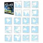
The SCHOOL ATLAS (ENGLISH) - MAPLITHO is an educational atlas designed for students. It provides a collection of maps that cover various regions, including countries, continents, and specific areas of study like India, world rivers, political maps, and physical maps. The atlas uses simple and easy-to-understand language to explain geographical information. It is a valuable resource to help students explore and learn about different places, their political divisions, and their physical features. The atlas contains a range of maps printed on quality map litho paper, making it durable and suitable for classroom use.
)
)
)
)
)
)
)
)
)
)